
飯能市 topographic map
Interactive map
Click on the map to display elevation.
About this map
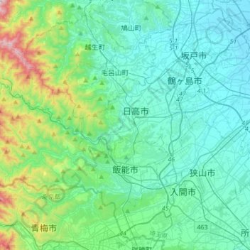
Name: 飯能市 topographic map, elevation, terrain.
Location: 飯能市, 埼玉県, 日本 (35.81877 139.10022 35.96974 139.37469)
Average elevation: 158 m
Minimum elevation: 12 m
Maximum elevation: 859 m
Other topographic maps
Click on a map to view its topography, its elevation and its terrain.