
柏市 topographic map
Interactive map
Click on the map to display elevation.
About this map
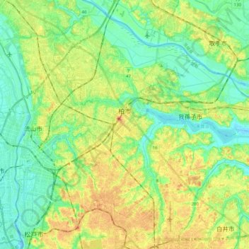
Name: 柏市 topographic map, elevation, terrain.
Location: 柏市, 千葉県, 日本 (35.78122 139.91332 35.93585 140.11194)
Average elevation: 17 m
Minimum elevation: -6 m
Maximum elevation: 40 m
Other topographic maps
Click on a map to view its topography, its elevation and its terrain.