
白山市 topographic map
Interactive map
Click on the map to display elevation.
About this map
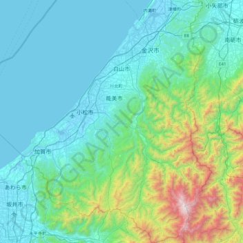
Name: 白山市 topographic map, elevation, terrain.
Location: 白山市, 石川県, 中部地方, 日本 (36.06723 136.26000 36.68787 136.85182)
Average elevation: 387 m
Minimum elevation: -5 m
Maximum elevation: 2,666 m
Other topographic maps
Click on a map to view its topography, its elevation and its terrain.