
板橋区 topographic map
Interactive map
Click on the map to display elevation.
About this map
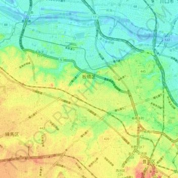
Name: 板橋区 topographic map, elevation, terrain.
Location: 板橋区, 東京都, 日本 (35.73578 139.62457 35.80083 139.72276)
Average elevation: 25 m
Minimum elevation: -7 m
Maximum elevation: 59 m
Other topographic maps
Click on a map to view its topography, its elevation and its terrain.