
山口市 topographic map
Interactive map
Click on the map to display elevation.
About this map
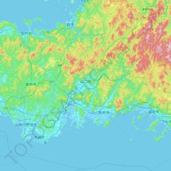
Name: 山口市 topographic map, elevation, terrain.
Location: 山口市, 山口県, 日本 (33.81269 131.29202 34.50451 131.79551)
Average elevation: 170 m
Minimum elevation: -5 m
Maximum elevation: 1,036 m
Other topographic maps
Click on a map to view its topography, its elevation and its terrain.