
山形市 topographic map
Interactive map
Click on the map to display elevation.
About this map
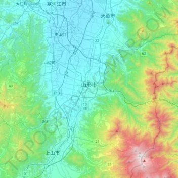
Name: 山形市 topographic map, elevation, terrain.
Location: 山形市, 山形県, 日本 (38.14350 140.17924 38.35199 140.53068)
Average elevation: 458 m
Minimum elevation: 80 m
Maximum elevation: 1,836 m
Other topographic maps
Click on a map to view its topography, its elevation and its terrain.