
市川市 topographic map
Interactive map
Click on the map to display elevation.
About this map
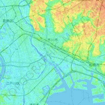
Name: 市川市 topographic map, elevation, terrain.
Location: 市川市, 千葉県, 日本 (35.65248 139.88553 35.77568 139.97684)
Average elevation: 9 m
Minimum elevation: -5 m
Maximum elevation: 34 m
Other topographic maps
Click on a map to view its topography, its elevation and its terrain.