
千代田区 topographic map
Interactive map
Click on the map to display elevation.
About this map
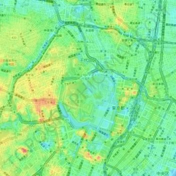
Name: 千代田区 topographic map, elevation, terrain.
Location: 千代田区, 東京都, 日本 (35.66863 139.73013 35.70525 139.78284)
Average elevation: 23 m
Minimum elevation: -3 m
Maximum elevation: 58 m
Other topographic maps
Click on a map to view its topography, its elevation and its terrain.