
狭山市 topographic map
Interactive map
Click on the map to display elevation.
About this map
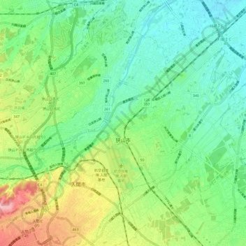
Name: 狭山市 topographic map, elevation, terrain.
Location: 狭山市, 埼玉県, 日本 (35.81771 139.36089 35.90095 139.47831)
Average elevation: 69 m
Minimum elevation: 21 m
Maximum elevation: 170 m
Other topographic maps
Click on a map to view its topography, its elevation and its terrain.