
倉敷市 topographic map
Interactive map
Click on the map to display elevation.
About this map
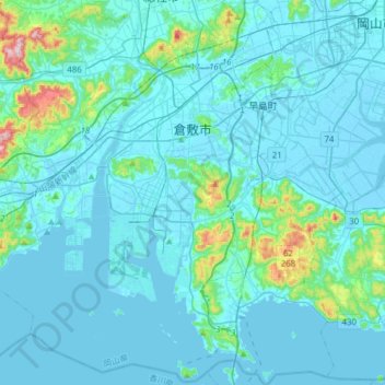
Name: 倉敷市 topographic map, elevation, terrain.
Location: 倉敷市, 岡山県, 日本 (34.41486 133.60243 34.66947 133.88551)
Average elevation: 36 m
Minimum elevation: -5 m
Maximum elevation: 388 m
Other topographic maps
Click on a map to view its topography, its elevation and its terrain.