
松山市 topographic map
Interactive map
Click on the map to display elevation.
About this map
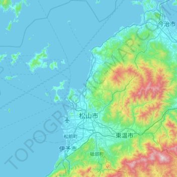
Name: 松山市 topographic map, elevation, terrain.
Location: 松山市, 愛媛県, 日本 (33.68736 132.44644 34.12280 132.92680)
Average elevation: 174 m
Minimum elevation: -1 m
Maximum elevation: 1,413 m
Other topographic maps
Click on a map to view its topography, its elevation and its terrain.