
川口市 topographic map
Interactive map
Click on the map to display elevation.
About this map
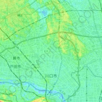
Name: 川口市 topographic map, elevation, terrain.
Location: 川口市, 埼玉県, 日本 (35.78018 139.67520 35.88707 139.78828)
Average elevation: 9 m
Minimum elevation: -6 m
Maximum elevation: 33 m
Other topographic maps
Click on a map to view its topography, its elevation and its terrain.