
立川市 topographic map
Interactive map
Click on the map to display elevation.
About this map
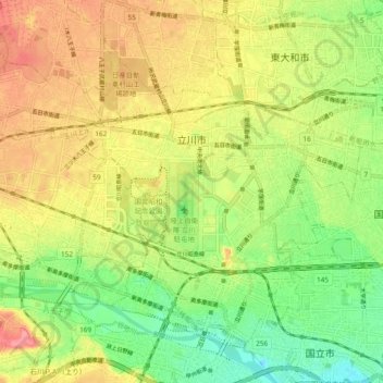
Name: 立川市 topographic map, elevation, terrain.
Location: 立川市, 東京都, 日本 (35.68276 139.35233 35.74514 139.44612)
Average elevation: 97 m
Minimum elevation: 54 m
Maximum elevation: 142 m
東京都の島嶼部を除く地域の中央よりやや西側の、多摩川中流左岸武蔵野台地上に位置する。市域のほとんどは平地であるが、南部の多摩川沿いに立川崖線、北東端に国分寺崖線が見られる。標高は北部から南部へゆるやかに低くなっており、南北に残堀川が流れ、市北部の一部(0.7km2)のみ玉川上水を分水嶺とし荒川水系域となっている。
Other topographic maps
Click on a map to view its topography, its elevation and its terrain.