
茅ヶ崎市 topographic map
Interactive map
Click on the map to display elevation.
About this map
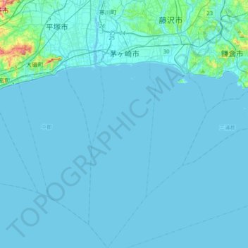
Name: 茅ヶ崎市 topographic map, elevation, terrain.
Location: 茅ヶ崎市, 神奈川県, 日本 (35.12375 139.35897 35.38492 139.44561)
Average elevation: 9 m
Minimum elevation: -2 m
Maximum elevation: 228 m
Other topographic maps
Click on a map to view its topography, its elevation and its terrain.