
藤沢市 topographic map
Interactive map
Click on the map to display elevation.
About this map
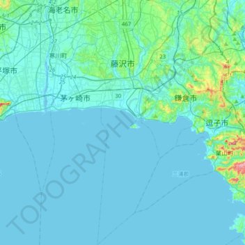
Name: 藤沢市 topographic map, elevation, terrain.
Location: 藤沢市, 神奈川県, 日本 (35.17795 139.39398 35.42909 139.51685)
Average elevation: 17 m
Minimum elevation: -3 m
Maximum elevation: 205 m
Other topographic maps
Click on a map to view its topography, its elevation and its terrain.