
伊豆半島 topographic map
Interactive map
Click on the map to display elevation.
About this map
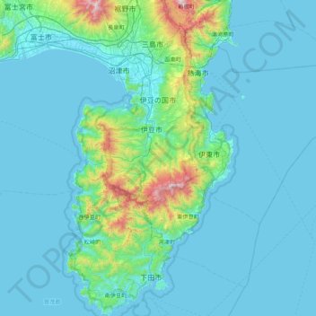
Name: 伊豆半島 topographic map, elevation, terrain.
Location: 伊豆半島, 静岡県, 中部地方, 日本 (34.60084 138.73907 35.23394 139.16123)
Average elevation: 132 m
Minimum elevation: 0 m
Maximum elevation: 1,416 m
Other topographic maps
Click on a map to view its topography, its elevation and its terrain.