
飯田市 topographic map
Interactive map
Click on the map to display elevation.
About this map
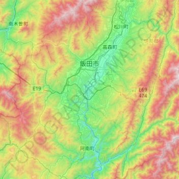
Name: 飯田市 topographic map, elevation, terrain.
Location: 飯田市, 長野県, 日本 (35.25333 137.68922 35.65568 138.15314)
Average elevation: 1,026 m
Minimum elevation: 261 m
Maximum elevation: 2,417 m
代表的な山には標高を掲載した。
Other topographic maps
Click on a map to view its topography, its elevation and its terrain.