
浜松市 topographic map
Interactive map
Click on the map to display elevation.
About this map
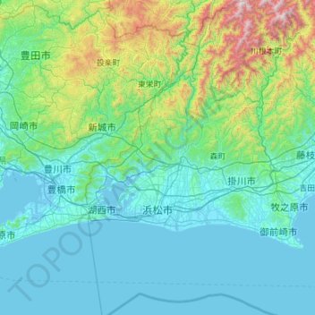
Name: 浜松市 topographic map, elevation, terrain.
Location: 浜松市, 静岡県, 中部地方, 日本 (34.40647 137.48685 35.30440 138.05870)
Average elevation: 292 m
Minimum elevation: -4 m
Maximum elevation: 2,278 m
Other topographic maps
Click on a map to view its topography, its elevation and its terrain.