
位山 topographic map
Interactive map
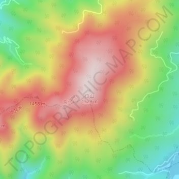
Click on the map to display elevation.
About this map
Name: 位山 topographic map, elevation, terrain.
Location: 位山, 高山市, 岐阜県, 日本 (36.03820 137.19666 36.03830 137.19676)
Average elevation: 1,268 m
Minimum elevation: 1,005 m
Maximum elevation: 1,514 m
位山(くらいやま)は、飛騨高地の中央に位置する岐阜県高山市の標高1,529mの山。 飛騨北部と南部の境界であり宮川と飛騨川の分水界である位山分水嶺の山。 飛騨一宮水無神社の神体である。日本二百名山のひとつであり、山域は岐阜県の「位山舟山県立自然公園」に指定されている。
Other topographic maps
Click on a map to view its topography, its elevation and its terrain.