
権現池 topographic map
Interactive map
Click on the map to display elevation.
About this map
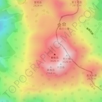
Name: 権現池 topographic map, elevation, terrain.
Location: 権現池, 高山市, 岐阜県, 日本 (36.10664 137.54719 36.10868 137.54929)
Average elevation: 2,685 m
Minimum elevation: 2,258 m
Maximum elevation: 3,008 m
Other topographic maps
Click on a map to view its topography, its elevation and its terrain.