
大日岳 topographic map
Interactive map
Click on the map to display elevation.
About this map
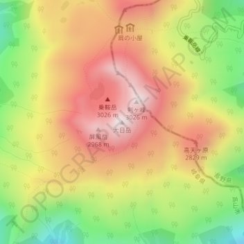
Name: 大日岳 topographic map, elevation, terrain.
Location: 大日岳, 高山市, 岐阜県, 日本 (36.10419 137.55162 36.10429 137.55172)
Average elevation: 2,669 m
Minimum elevation: 2,269 m
Maximum elevation: 3,008 m
Other topographic maps
Click on a map to view its topography, its elevation and its terrain.