
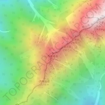
西穂高岳 topographic map
Interactive map
Click on the map to display elevation.
About this map
Name: 西穂高岳 topographic map, elevation, terrain.
Location: 西穂高岳, 高山市, 岐阜県, 日本 (36.27897 137.62900 36.27907 137.62910)
Average elevation: 2,363 m
Minimum elevation: 1,752 m
Maximum elevation: 3,139 m
西穂高岳(にしほたかだけ)は、長野県松本市と岐阜県高山市にまたがる標高2,909 mの飛騨山脈(北アルプス)南部の山である。山域は中部山岳国立公園に指定され、花の百名山に選定されている。
Other topographic maps
Click on a map to view its topography, its elevation and its terrain.