
無数河川 topographic map
Interactive map
Click on the map to display elevation.
About this map
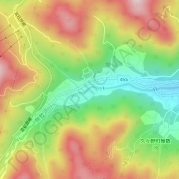
Name: 無数河川 topographic map, elevation, terrain.
Location: 無数河川, 高山市, 岐阜県, 日本 (36.05207 137.23804 36.05287 137.23985)
Average elevation: 880 m
Minimum elevation: 704 m
Maximum elevation: 1,057 m
Other topographic maps
Click on a map to view its topography, its elevation and its terrain.