
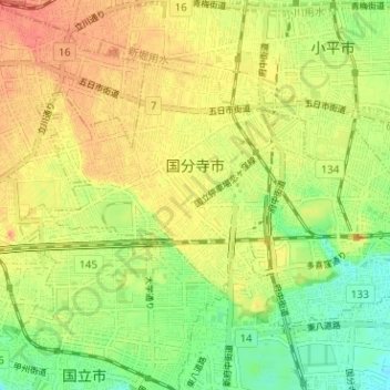
国分寺市 topographic map
Interactive map
Click on the map to display elevation.
About this map
Name: 国分寺市 topographic map, elevation, terrain.
Location: 国分寺市, 東京都, 日本 (35.68833 139.42826 35.72288 139.49158)
Average elevation: 82 m
Minimum elevation: 56 m
Maximum elevation: 103 m
海底時代、陸北時代、武蔵野台地形成時代、立川台地形成時代を経て現在の地盤ができ、表土から下へ関東ローム層、砂礫層、そして岩盤(連光寺互層)となる。
Other topographic maps
Click on a map to view its topography, its elevation and its terrain.