
中田南 topographic map
Interactive map
Click on the map to display elevation.
About this map
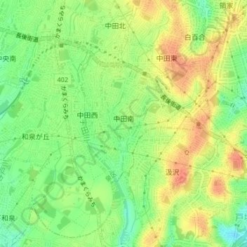
Name: 中田南 topographic map, elevation, terrain.
Location: 中田南, 泉区, 横浜市, 神奈川県, 245-0014, 日本 (35.39920 139.50529 35.41209 139.51911)
Average elevation: 47 m
Minimum elevation: 21 m
Maximum elevation: 71 m
Other topographic maps
Click on a map to view its topography, its elevation and its terrain.