
泉区 topographic map
Interactive map
Click on the map to display elevation.
About this map
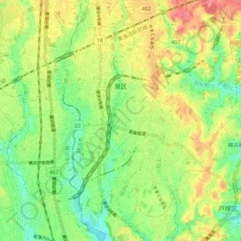
Name: 泉区 topographic map, elevation, terrain.
Location: 泉区, 横浜市, 神奈川県, 231-0017, 日本 (35.38695 139.47272 35.44961 139.53097)
Average elevation: 44 m
Minimum elevation: 10 m
Maximum elevation: 86 m
Other topographic maps
Click on a map to view its topography, its elevation and its terrain.