
和泉町 topographic map
Interactive map
Click on the map to display elevation.
About this map
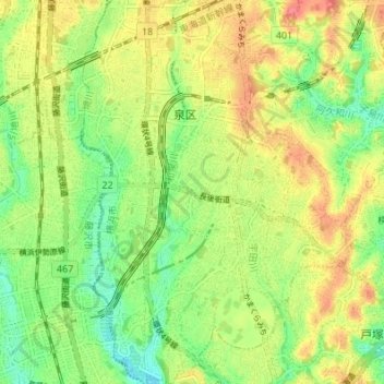
Name: 和泉町 topographic map, elevation, terrain.
Location: 和泉町, 泉区, 横浜市, 神奈川県, 231-0017, 日本 (35.38824 139.48295 35.44370 139.50531)
Average elevation: 43 m
Minimum elevation: 11 m
Maximum elevation: 79 m
Other topographic maps
Click on a map to view its topography, its elevation and its terrain.