
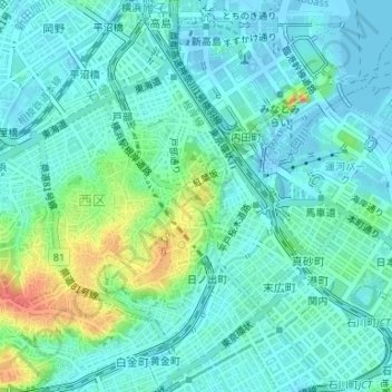
伊勢山(横浜市西区宮崎町) topographic map
Interactive map
Click on the map to display elevation.
About this map
Name: 伊勢山(横浜市西区宮崎町) topographic map, elevation, terrain.
Location: 伊勢山(横浜市西区宮崎町), 横浜市, 神奈川県, 231-0017, 日本 (35.45016 139.62575 35.45026 139.62585)
Average elevation: 13 m
Minimum elevation: -17 m
Maximum elevation: 53 m
Other topographic maps
Click on a map to view its topography, its elevation and its terrain.