
南区 topographic map
Interactive map
Click on the map to display elevation.
About this map
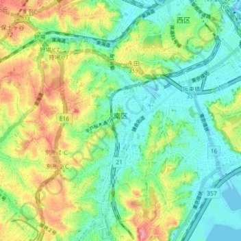
Name: 南区 topographic map, elevation, terrain.
Location: 南区, 横浜市, 神奈川県, 231-0017, 日本 (35.40812 139.56991 35.44434 139.63966)
Average elevation: 32 m
Minimum elevation: -16 m
Maximum elevation: 88 m
Other topographic maps
Click on a map to view its topography, its elevation and its terrain.