
磯子区 topographic map
Interactive map
Click on the map to display elevation.
About this map
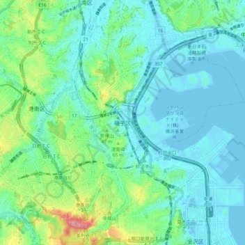
Name: 磯子区 topographic map, elevation, terrain.
Location: 磯子区, 横浜市, 神奈川県, 231-0017, 日本 (35.35465 139.58757 35.42799 139.65650)
Average elevation: 31 m
Minimum elevation: -4 m
Maximum elevation: 149 m
Other topographic maps
Click on a map to view its topography, its elevation and its terrain.