
西区 topographic map
Interactive map
Click on the map to display elevation.
About this map
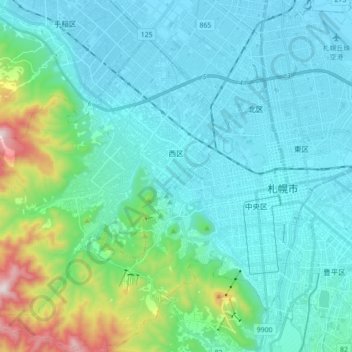
Name: 西区 topographic map, elevation, terrain.
Location: 西区, 札幌市, 石狩振興局, 北海道, 日本 (43.01517 141.15258 43.11676 141.32811)
Average elevation: 141 m
Minimum elevation: 3 m
Maximum elevation: 854 m
Other topographic maps
Click on a map to view its topography, its elevation and its terrain.