
北ノ沢3 topographic map
Interactive map
Click on the map to display elevation.
About this map
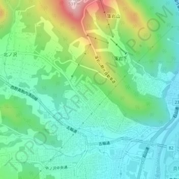
Name: 北ノ沢3 topographic map, elevation, terrain.
Location: 北ノ沢3, 北ノ沢, 南区, 札幌市, 石狩振興局, 北海道, 日本 (43.00558 141.32247 43.01013 141.32789)
Average elevation: 180 m
Minimum elevation: 54 m
Maximum elevation: 507 m
Other topographic maps
Click on a map to view its topography, its elevation and its terrain.