
清田区 topographic map
Interactive map
Click on the map to display elevation.
About this map
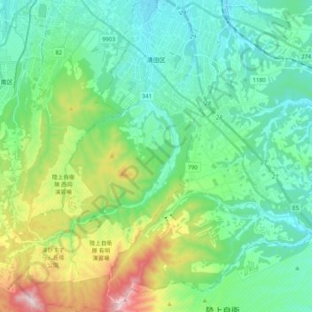
Name: 清田区 topographic map, elevation, terrain.
Location: 清田区, 札幌市, 石狩振興局, 北海道, 日本 (42.88820 141.38653 43.02596 141.48242)
Average elevation: 143 m
Minimum elevation: 19 m
Maximum elevation: 515 m
Other topographic maps
Click on a map to view its topography, its elevation and its terrain.