
新潟県 topographic map
Interactive map
Click on the map to display elevation.
About this map
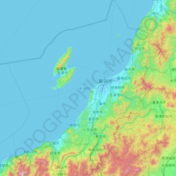
Name: 新潟県 topographic map, elevation, terrain.
Location: 新潟県, 中部地方, 日本 (36.73653 137.53163 38.89731 139.89989)
Average elevation: 285 m
Minimum elevation: -3 m
Maximum elevation: 2,922 m
Other topographic maps
Click on a map to view its topography, its elevation and its terrain.