
鳥取市 topographic map
Interactive map
Click on the map to display elevation.
About this map
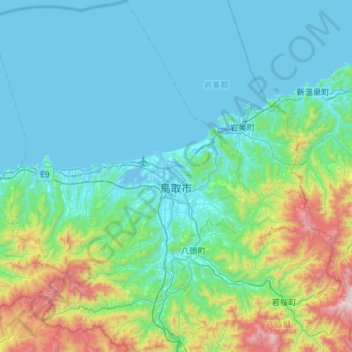
Name: 鳥取市 topographic map, elevation, terrain.
Location: 鳥取市, 鳥取県, 日本 (35.27168 133.91173 35.74607 134.44077)
Average elevation: 245 m
Minimum elevation: -4 m
Maximum elevation: 1,468 m
Other topographic maps
Click on a map to view its topography, its elevation and its terrain.