
那須塩原市 topographic map
Interactive map
Click on the map to display elevation.
About this map
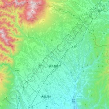
Name: 那須塩原市 topographic map, elevation, terrain.
Location: 那須塩原市, 栃木県, 日本 (36.83691 139.73296 37.15506 140.14125)
Average elevation: 513 m
Minimum elevation: 141 m
Maximum elevation: 1,899 m
標高200-250mの西那須野、黒磯地区等の平野部は、内陸性気候に属し、東京より若干気温が低い程度であり、夏は非常に蒸し暑く、雷雲、雷も発生し、冬は山から吹きおろす空っ風(北風)が強く非常に寒いが、降雪は年に1~3度程度である。
Other topographic maps
Click on a map to view its topography, its elevation and its terrain.