
四條畷市 topographic map
Interactive map
Click on the map to display elevation.
About this map
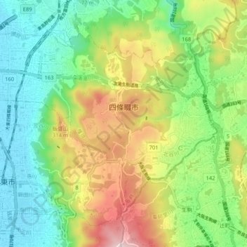
Name: 四條畷市 topographic map, elevation, terrain.
Location: 四條畷市, 大阪府, 日本 (34.70177 135.62436 34.74998 135.70414)
Average elevation: 168 m
Minimum elevation: 4 m
Maximum elevation: 452 m
Other topographic maps
Click on a map to view its topography, its elevation and its terrain.