
夢洲 topographic map
Interactive map
Click on the map to display elevation.
About this map
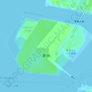
Name: 夢洲 topographic map, elevation, terrain.
Location: 夢洲, 大阪市, 大阪府, 日本 (34.64183 135.37288 34.66011 135.40450)
Average elevation: 2 m
Minimum elevation: -4 m
Maximum elevation: 9 m
Other topographic maps
Click on a map to view its topography, its elevation and its terrain.