
西淀川区 topographic map
Interactive map
Click on the map to display elevation.
About this map
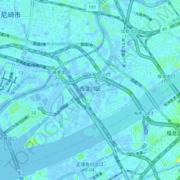
Name: 西淀川区 topographic map, elevation, terrain.
Location: 西淀川区, 大阪市, 大阪府, 日本 (34.68141 135.40604 34.72908 135.47393)
Average elevation: 1 m
Minimum elevation: -16 m
Maximum elevation: 16 m
Other topographic maps
Click on a map to view its topography, its elevation and its terrain.