
生口島 topographic map
Interactive map
Click on the map to display elevation.
About this map
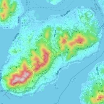
Name: 生口島 topographic map, elevation, terrain.
Location: 生口島, 尾道市, 広島県, 日本 (34.25599 133.06726 34.31663 133.14993)
Average elevation: 65 m
Minimum elevation: 0 m
Maximum elevation: 450 m
面積31.21km2 (2014年10月時点)。地質はほぼ花崗岩で形成されている。島の最高峰は観音山(標高472.3m)で、次が牡蠣山(標高408.1m)。特に観音山は芸予諸島内での最高峰で、雨乞い祈祷場であり、そして瀬戸内海を拠点とした水軍が狼煙台を置いていたことから別名“火瀧山”とも呼ばれている。
Other topographic maps
Click on a map to view its topography, its elevation and its terrain.