
因島 topographic map
Interactive map
Click on the map to display elevation.
About this map
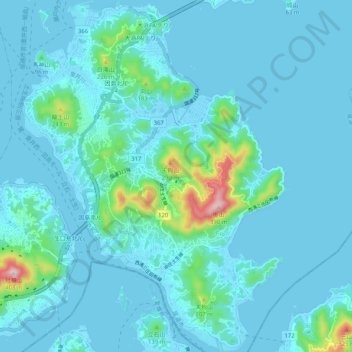
Name: 因島 topographic map, elevation, terrain.
Location: 因島, 尾道市, 広島県, 722-2102, 日本 (34.27493 133.13377 34.35937 133.21150)
Average elevation: 37 m
Minimum elevation: -2 m
Maximum elevation: 383 m
島の北側にある白滝山は、標高226.9mで山頂は因島大橋を見下ろせる。この山頂から参道にかけて五百羅漢の石仏が点在する。
Other topographic maps
Click on a map to view its topography, its elevation and its terrain.