
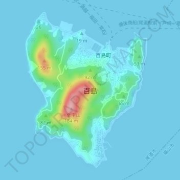
百島 topographic map
Interactive map
Click on the map to display elevation.
About this map
Name: 百島 topographic map, elevation, terrain.
Location: 百島, 尾道市, 広島県, 日本 (34.36082 133.25734 34.38423 133.27943)
Average elevation: 14 m
Minimum elevation: 0 m
Maximum elevation: 155 m
Other topographic maps
Click on a map to view its topography, its elevation and its terrain.