
中野ダム topographic map
Interactive map
Click on the map to display elevation.
About this map
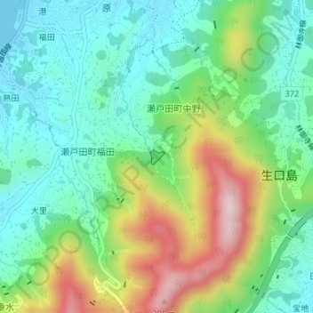
Name: 中野ダム topographic map, elevation, terrain.
Location: 中野ダム, 瀬戸田町中野, 尾道市, 広島県, 日本 (34.28730 133.09576 34.28854 133.09726)
Average elevation: 126 m
Minimum elevation: 0 m
Maximum elevation: 385 m
Other topographic maps
Click on a map to view its topography, its elevation and its terrain.