
高根島 topographic map
Interactive map
Click on the map to display elevation.
About this map
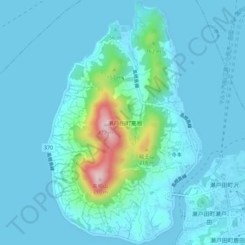
Name: 高根島 topographic map, elevation, terrain.
Location: 高根島, 尾道市, 広島県, 722-2412, 日本 (34.30126 133.06192 34.33420 133.08716)
Average elevation: 34 m
Minimum elevation: -1 m
Maximum elevation: 290 m
瀬戸内の柑橘畑の特徴としては山頂まで続く急峻な石積みの段々畑が有名であるが、高根島では、標高100m辺りで農地が終端を迎えており、その終端部でも石積みの段々畑になっていない(農道や農地の高低差回避のための石積みはある)。
Other topographic maps
Click on a map to view its topography, its elevation and its terrain.