
伏見区 topographic map
Interactive map
Click on the map to display elevation.
About this map
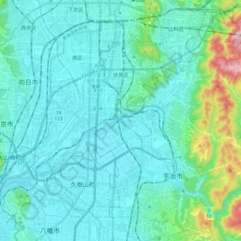
Name: 伏見区 topographic map, elevation, terrain.
Location: 伏見区, 京都市, 京都府, 日本 (34.87492 135.70317 34.97718 135.87844)
Average elevation: 79 m
Minimum elevation: 0 m
Maximum elevation: 572 m
なお、醍醐支所管内は伏見区中心部よりも地形的、歴史的に同じ宇治郡だった山科区との結びつきの方が圧倒的に強いため、同管内のみを分離して山科区に編入する方が合理的とする考え方もある。
Other topographic maps
Click on a map to view its topography, its elevation and its terrain.