
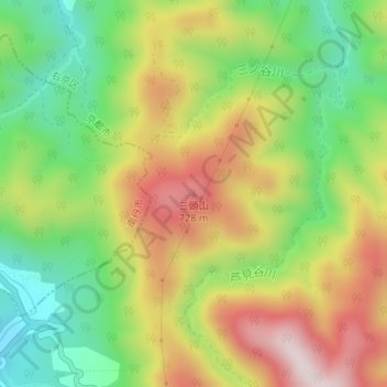
三頭山 topographic map
Interactive map
Click on the map to display elevation.
About this map
Name: 三頭山 topographic map, elevation, terrain.
Location: 三頭山, 京都市, 京都府, 616-8458, 日本 (35.10115 135.62004 35.10125 135.62014)
Average elevation: 514 m
Minimum elevation: 290 m
Maximum elevation: 779 m
Other topographic maps
Click on a map to view its topography, its elevation and its terrain.