
山ノ内赤山町 topographic map
Interactive map
Click on the map to display elevation.
About this map
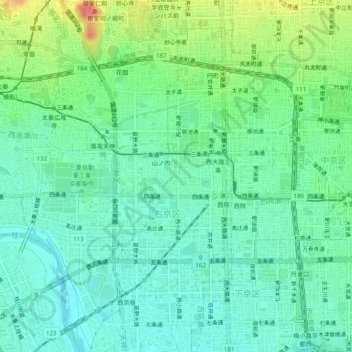
Name: 山ノ内赤山町 topographic map, elevation, terrain.
Location: 山ノ内赤山町, 右京区, 京都市, 京都府, 615-0051, 日本 (34.98573 135.70530 35.02573 135.74530)
Average elevation: 38 m
Minimum elevation: 15 m
Maximum elevation: 93 m