
右京区 topographic map
Interactive map
Click on the map to display elevation.
About this map
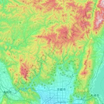
Name: 右京区 topographic map, elevation, terrain.
Location: 右京区, 京都市, 京都府, 日本 (34.98005 135.55901 35.26777 135.77542)
Average elevation: 382 m
Minimum elevation: 17 m
Maximum elevation: 1,178 m
Other topographic maps
Click on a map to view its topography, its elevation and its terrain.