
大唐松山 topographic map
Interactive map
Click on the map to display elevation.
About this map
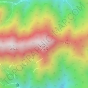
Name: 大唐松山 topographic map, elevation, terrain.
Location: 大唐松山, 早川町, 南巨摩郡, 山梨県, 日本 (35.62154 138.26939 35.62164 138.26949)
Average elevation: 2,043 m
Minimum elevation: 1,554 m
Maximum elevation: 2,541 m
Other topographic maps
Click on a map to view its topography, its elevation and its terrain.