
山伏 topographic map
Interactive map
Click on the map to display elevation.
About this map
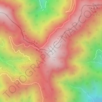
Name: 山伏 topographic map, elevation, terrain.
Location: 山伏, 早川町, 南巨摩郡, 山梨県, 日本 (35.30431 138.28522 35.30441 138.28532)
Average elevation: 1,660 m
Minimum elevation: 1,098 m
Maximum elevation: 2,005 m
山伏(やんぶし)は、山梨県南巨摩郡早川町と静岡県静岡市葵区との境にある山である。赤石山脈の白峰南嶺に続く山で、同嶺の最南の2,000m峰であり、安倍川流域の最高峰でもある。標高2,013.2m。
Other topographic maps
Click on a map to view its topography, its elevation and its terrain.